
The First and Only Weekly Online Fanzine Devoted to the Life and Works of Edgar Rice Burroughs Since 1996 ~ 15,000 Webpages and Webzines |
 |
|
The First and Only Weekly Online Fanzine Devoted to the Life and Works of Edgar Rice Burroughs Since 1996 ~ 15,000 Webpages and Webzines |
|
![]()
Presents
Huck's
Gazetteer & Glossary
of Barsoom
by J. G. Huckenpöhler
![]()
Welcome to Huck's Original Barsoomian
Gazetteer and Glossary
This valuable resource by one
of ERB fandom's best-known scholars first appeared in 1970
when it was serialized in the
award-winning fanzine, ERBdom.
Huck's Gazetteer was first published
in ERB Amateur Press Association journal #50.
![]()
PART I: GAZETTEER
This Gazetteer was first featured in ERB-APA #50. It is presented here with the full consent of the author.
| AAANTHOR | Dead city in the no-man's land between Torquas and Thurd. Located at 50o S., and 40o E. of Horz. In the Mare Australe, southwest of Hellas. |
| AMHOR | City and kingdom of red men, about 2,000 haads north of a point about 350 haads west of Gooli. This would put it in Ortygia, at the junction of Jaxartes and the canal Cedron. |
| ARTOLIAN
HILLS |
Range of hills lying between Duhor and Toonol and extending to the former. In Arcadia. |
| ATMOSPHERE
PLANT |
Installation regulating the Martian atmosphere, which is largely artificial. Located about 2,500 haads (ten days by thoat) from Zodanga, near a Zodangan canal (Antaeus). This puts it in Atlantis, at about 35o N., 160o W. |
| BANTOOM | Valley in the southern hemisphere, about 4,000 haads, southwest of Torquas, and 11,000 haads west-southwest of Helium. In southeastern Aurorae Sinus. |
| CARRION CAVES | Series of Caverns at the edge of the Arctic icecap, about one-sixth of the way around the planet from Kaol. |
| DUHOR | City and empire of red men. Located 5,000 haads west of Amhor, 7,800 haads from Toonol, and 10,500 haads from Helium (but northeast, not northwest). At Schiaparelli's Castorius Lacus. Here Vor Daj underestimates the distance from the point at 15o N., 150o W. of Exum. (This may be an error in transcription; both distances would fit a point 25o N. of the equator. This is not unlikely, given that we receive the story at fourth hand by way of Ulysses Paxton, Jason Gridley, and Burroughs.) |
| DUSAR | City and empire of red men. Its capital, of the same name, is situated at 15o N., 20o E. of Horz, at the intersection of the canals Orontes and Euphrates I. |
| EXUM | Dead city, Barsoomian Greenwich in Synthetic Men of Mars and later stories. Its exact location is not given, but we are told that a line drawn between Lesser Helium and Horz bisects the equator about 1,600 miles (4,320 haads) east of the prime meridian. |
| FIRST BORN,
VALLEY OF THE |
Empire of the Black Pirates, about 2,500 haads soutwest of Horz. This would place it in the eastern portion of the Niliacus Lacus. |
| GATHOL | City and kingdom of red men. Extends from the equator to 10o N., and from 10o to 20o W. of Horz. In southern Thymiamata. The city is not pinpointed within this area; however, since the kingdom was originally an island which spread as the sea level fell, and eventually became a mountain, it is logical to place the city near the center of the area. |
| GHASTA | Capital of the kingdom of Hohr (q.v.), southwest of Tjanath, perhaps forty haads inside the border. |
| GOLDEN
CLIFFS |
Mountain range, possibly the walls of an impact crater, surrounding the Valley Dor at the south pole. |
| GOOLI | City and kingdom of marsupial men, on the island of Ompt, in the Toonolian Marshes. |
| HASTOR | City subject to Helium, about 500 haads south of Lesser Helium. At the southern edge of the Tyrrhenium Mare. |
| HELIUM
FOREST |
Wooded area in the Valley of Helium, northwest of the Twin Cities. This would make it equivalent to the Tyrrhenium Mare. |
| HELIUM | Empire of red men. Its capital, GREATER HELIUM, famous for its mile-high Scarlet Tower, is at 30o S., and more than 5,100 haads west of Zodanga. I place it at Percival Lowell's Hesperidum Lucus. |
| HELIUM,
LESSER |
Second city of the Empire of Helium, famous for its Golden Tower. It lies 200 haads northwest of Greater Helium. |
| HELIUM,
VALLEY OF |
Valley lying between Greater Helium and Lesser Helium, and stretching away to the northwest. Schiaparelli's Tyrrhenium Mare. |
| HOHR | Kingdom of red men in the crater of an extinct volcano, one day's walk (in the dark, probably less than 100 haads) southwest of Tjanath. Schiaparelli's Dia. |
| HORZ | City and empire of Orovars. On the prime meridian, 4,000 haads north-northeast of Gathol, and 5,000 miles (13,500 haads) northwest of Lesser Helium. The latter point is some 800 haads north of the former, since both are rounded to the nearest thousand. I placed it midway between the two, in southern Cydonia. |
| ILLALL | Okar city, in the Arctic icecap, remote from the capital. |
| INVAK | City and empire of red men in the Forest of Lost Men (Syrtis Major). There are no clues as to its location except that it was Invak that John Carter reached firs; therefore it is presumably the further west of the two cities in the valley. |
| ISSUS,
TEMPLE OF |
Golden temple, the Holy of Holies of the First Born, on the shore of the Lost Sea of Korus at the South Pole. |
| ISS, RIVER | The sacred river of the dead. Its source, or at least its main source is probably in the Arctic icecap, but certainly as far north as the latitude of Ptarth. It flows southward, probably through Jaxartes, Mare Acidalium, Niliacus Lacus, and via the Indus to the Margaritifer Sinus, and thence from Pandorae Fretum into Hellespontus and icecap at about 170o E. of Horz. Its tributaries are probably also called Iss; they seem to extend through or run near most of the major centers of population. One of these probably rises in Coloe Palus and flows southward through the Nylosyrtis into Syrtis Major, through the Mare Tyrrhenium (and Heliumetic territory) to Promethei Sinus, where it joins the main river. |
| JAHAR | City and empire of red men in the Western Hemisphere. The capital city is about 2,500 haads east of Jhama (but not due east; probably a little north of east). In the southern portion of the Mare Erythraeum, between Ogygis Regio and Argyre I. |
| JHAMA | Abandoned castle used as a laboratory by Phor Tak, located 1,500 haads northeast of Tjanath. In Ogygis Regio. |
| KADABRA | Capital city of the Empire of Okar, near the north pole. |
| KAMTOL | Capital city of the Valley of the First Born. There are no clues to its location within the valley, except that it is visible from the northeastern rim; therefore, it is probably east of the Hydaspes canal. |
| KAOL | City and empire of red men. In the Eastern Hemisphere, almost halfway around the planet from Helium (on p. 86 of Warlord appear the words "to the east"; it should read "to the west"), on the equator. The only possible site is in the Sunus Sabaeus, just east of the prime meridian. |
| KOBOL | City and kingdom on red men. No clues as to its location except John Carter's statement in Fighting Man concerning Kal Tavan: "Having been born in Tjanath and served in Kobol, he was more familiar with this part of Barsoom than any man in Helium." Yet Hin Abtol sacked the city on his way from Pankor to Gathol. Presumably, then, it lies somewhere within the triangle formed by Jahar, Pankor, and Gathol., and probably closest to Jahar. On the strength of this I put it at the tip of the Aurorae Sinus, at Lowell's Auri Lacus. |
| KORAD | Dead city, occupied by the Tharks while visiting their northern incubator, and probably also by the Warhoons, who have an incubator just south of the city. It lies some 4,400 haads north of the city of Thark, and well north of the northern boundary of Tharkish territory -- in fact, almost on the equator. The most likely location is in Aeolis, just north of the canal Antaeus. |
| KORUS,
LOST SEA OF |
Open sea in the exact center of the Valley Dor, at the south pole. |
| KORVAS | Dead city southeast of Helium, about 1,500 haads (a little over three hours by flier) to 2,400 haads (about 30 hours by malagor). Probably lies somewhere along the edge of the Mare Chronium (although possibly Xanthus; the malagors would be flying in the face of the prevailing winds, which should blow from northeast to southwest). I put it near the junction of the two. |
| KORVAS,
DEAD SEA OF |
Judging from the presumed location of Korvas, probably the Mare Chronium. |
| LOST MEN,
FOREST OF |
Sunken, fertile valley on the equator between Gathol and Helium. Probably part of Syrtis Major. |
| LOST SOULS,
VALLEY OF |
A portion of the Otz Valley, around the canyon of the Iss, near the south pole. |
| LOTHAR | City and empire of Orovars. The city is about 400 haads northwest of Aaanthor, in the Mare Australe. |
| LOTHARIAN
HILLS |
Range of mountains on the southeastern boundary of Torquas, surrounding Lothar. Also called the MOUNTAINS OF TORQUAS. |
| MANATAJ | The farthest city of the Empire of Manator. To the south and southeast lie the canal Hydraotes and Margaritifer Sinus; therefore Manataj must be north of Manator. |
| MANATOR | City and empire of red men, 22o west of Gathol. The boundary of the empire is about 10o west of Gathol. This would place it in Chryse, within the triangle formed by the canals Hydaspes, Hydraotes, and Jamuna. The city of Manator seems to lie in the western portion of the area. |
| MANATOS | City subject to Manator, probably the closest to Gathol. |
| MARENTINA | City and principality of yellow men, subject to Okar (though in rebellion at the beginning of Warlord). Situated near the Carrion Caves. |
| MORBUS | City of the Synthetic Men. Located on a large island in the Toonolian Marshes -- probably Scheria Insula, in the southern portion of the Mare Acidalium. |
| OKAR | Empire of the yellow men, occupying most of the Arctic icecap. |
| OMEAN | Subsurface ocean controlled by the Black Pirates or First Born, located near the south pole. The ENTRANCE TO OMEAN, the cone of an extinct volcano, from which the pirate fleets emerge, lies northwest of the Valley of Lost Souls, and some 2,700 haads south of Southern Warhoon (six hours by flier). |
| OMPT | Island in the Toonolian Marshes. Located to the west of Morbus, approximately six to eight hours by malagor or about 750 haads. |
| ONVAK | City and Empire of red men in the Forest of Lost Men (Syrtis Major), probably northeast of Invak. |
| OTZ
MOUNTAINS |
Circular mountain chain (possibly an impact crater), beginning 270 haads south of the northern boundary of the Otz Valley (q.v.) culminating in the Golden Cliffs, surrounding the south pole and the Lost Sea of Korus. Probably within the Antarctic icecap. |
| OTZ VALLEY | A large circular depression surrounding the Otz Mountains at the south pole, probably at least partly within the Antarctic icecap, but including also at least part of the Mare Australe. |
| PANAR | Empire of red men within the Arctic icecap (which it shares with Okar, the empire of the yellow men). |
| PANKOR | Capital of the Empire of Panar, within the Antarctic icecap. No information is given as to its location, so I placed it near the center of the area. |
| PHUNDAHL | City and empire of red men, at the western end of the Toonolian marshes. Vor Daj believed it to lie about 2,600 hours northeast of a point 15o N., 150o W. of Exum. He underestimates the distance; it is more like 3,200 haads, and almost due north. |
| POLODONA | The equator of Mars. |
| PTARTH | City and empire of red men. In the Eastern Hemisphere, 9,500 haads northeast of Helium and 13,500 haads east of Dusar. This would put it at the western end of Propontis I. |
| RAXAR | City and kingdom of red men. All we know about it is that it was sacked by Hin Abtol on his way to Gathol. Therefore, it should lie within the triangle formed by Gathol, Pankor, and Kobol. The likeliest spot is at the intersection of the canals Jamuna and Hydraotes. |
| SYL, RIVER | An underground river flowing southward from Tjanath and under Hohr, probably joining the Iss at about 75o S., 110o E. |
| THARK | City and empire of green men. The empire extends from 40o S. to 80o S., probably in Electris and Thyle I. The capital city is in the southwest corner, about ten days by thoat (2,000 haads) from Zodanga. This puts it at about 50oS.; thus we can deduce that the Tharkish Empire is shaped somewhat like the State of Nevada. The canal toward which John Carter and Dejah Thoris were fleeing was probably the Ascanius. |
| THAVAS | Island and castle in the Toonolian Marshes, ancestral home and laboratory of Ras Thavas. It lies just west of the city of Toonol. The city is visible from the highest tower of the castle, and it takes less than half an hour to fly the intervening distance in a slow cargo ship -- probably less than 50 haads. |
| THROXEUS or
THROXUS |
Mightiest of the five oceans of ancient Mars. On its shores were built Horz, Torquas, and Lothar; Gathol was built on an island in it. It probably covered Arabia, Eden, the Sinus Sabaeus, Mare Erythraeum, and Mare Australe. |
| THURD | City and empire of green men, near Torquas -- probably to the southeast, due south of Hellas. Aaanthor may be a Thurdish city; Thar Ban was in enemy territory. |
| TJANATH | City and kingdom of red men, 6,000 haads southwest of Xanator. In Dia, some 1,500 haads north of Thaumasia Foelix. |
| TOONOL | City and empire of red men at the eastern end of the Toonolian Marshes, 4,860 haads east of Phundahl. This would place it at the eastern end of the Mare Acidalium. |
| TOONOLIAN
MARSHES |
Extensive swamp in the Northern Hemisphere, the last remnant of the Throxeus Ocean. It extends some 4,860 haads between Phundahl on the west and Toonol on the east, and in places is 800 haads in width. The only dark area of this size in the Northern Hemisphere is Tanais. |
| TORQUAS | City and empire of green men in the Southern Hemisphere. The empire extends from Pandorae Fretum and Yaonis Regio into the Mare Australe. The city is some 7,000 haads west of helium, at the eastern tip of Hellespontus. |
| TORQUAS,
GULF OF |
Dead sea bottom extending southwest from the city of Torquas, equivalent to Schiaparelli's Hellespontus. |
| TORQUAS,
MOUINTAINS OF |
Range of mountains on the southeastern boundary of Torquas, surrounding Lothar. Also called the LOTHARIAN HILLS. |
| U-GOR | Province of the Empire of Jahar, located 1,000 haads southeast of the city of Jahar, 2,000 haads southwest of Xanator, and about 7,000 haads south of Gathol. The first two distances cited must have been rounded down to the nearest thousand; the actual distances are more like 1,400 haads from Jahar and 2,400 haads from Xanator. This would place it in Schiaparelli's Chalce. |
| WARHOON | City and empire of green men. The city is about 500 haads (15 days' walk) southeast of the Atmosphere Plant, in northern Phaethontis. The empire probably includes Phaethontis and adjacent portions of the Mare Australe and the eastern section of the Mare Chronium. (I believe that the so-called "Warhoons of the South" are the same people, and Kab Kadja is a successor of Dak Kova.) |
| XANATOR | City subject to Torquas. Located about 2,000 haads southwest of Torquas, on the Gulf of Torquas, which would put it in central Hellespontus, south of Noachis. |
| ZODANGA | City and empire of red men. The city is at 30o S., 172o E. I place it at the point where the canal Antaeus runs into the Mare Cimmerium. |
| ZOR | City subject to Helium, approximately 1,000 haads southeast of the Twin Cities. At the junction of Xanthus canal and Tyrrhenium Mare. |
To the All-Text Print-Out Page
![]()
JASOOMIAN
VERSION OF BARSOOM
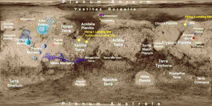
CARTOGRAPHY
REFERENCES
Featured
at
Atlas
of Edgar Rice Burroughs
![]()
HUCK'S LIST OF ERB PASTICHES
(A WORD File)
https://www.erbzine.com/mag0/pastiches.rtf
![]()
To Part II: Huck's Barsoom Glossary


![]()

![]()
BILL
HILLMAN
Visit
our thousands of other sites at:
BILL
and SUE-ON HILLMAN ECLECTIC STUDIO
ERB
Text, ERB Images and Tarzan® are ©Edgar Rice Burroughs, Inc.-
All Rights Reserved.
All
Original Work ©1996-2004/2011/2021 by Bill Hillman and/or Contributing
Authors/Owners
No
part of this web site may be reproduced without permission from the respective
owners.